
Tree logging equipment is stationed at Baker Butte near the Mogollon Rim on the Coconino National Forest on May 16, 2022. Joel Angel Juarez/The Republic
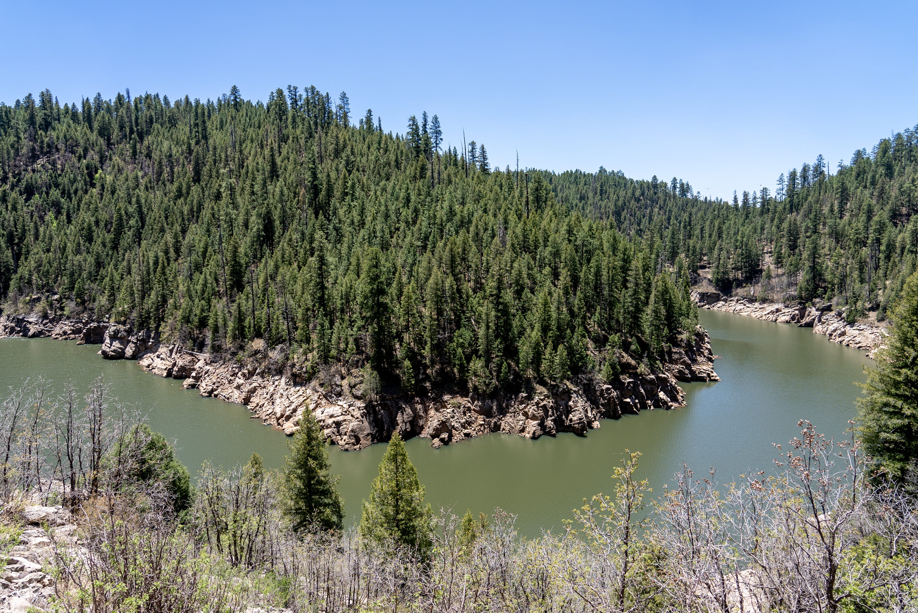
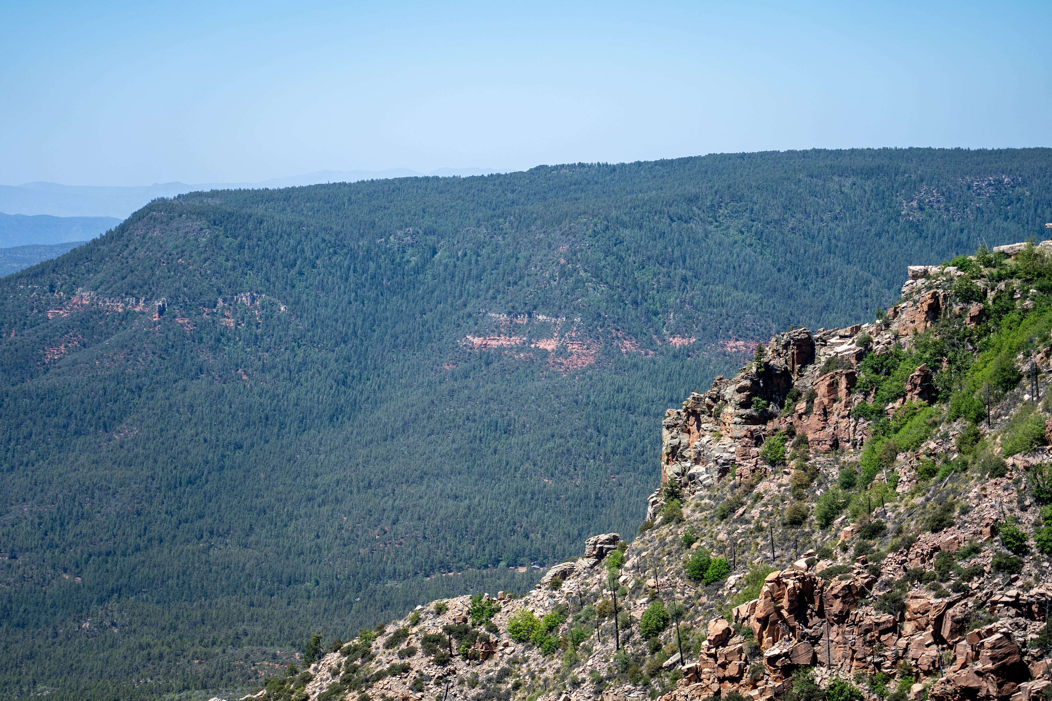
PINE — From atop the Baker Butte Lookout, a sea of evergreens, oaks and locusts spreads across the Mogollon Rim to the hazy horizon.
A broad-tailed hummingbird buzzes a feeder perched on the steel lattice tower, the food supplied by a U.S. Forest Service fire sentinel. Down the dirt road, but obscured by the dense tree cover, a band of spike-antlered and cow elk shuffle and munch in the warmth of a May afternoon.
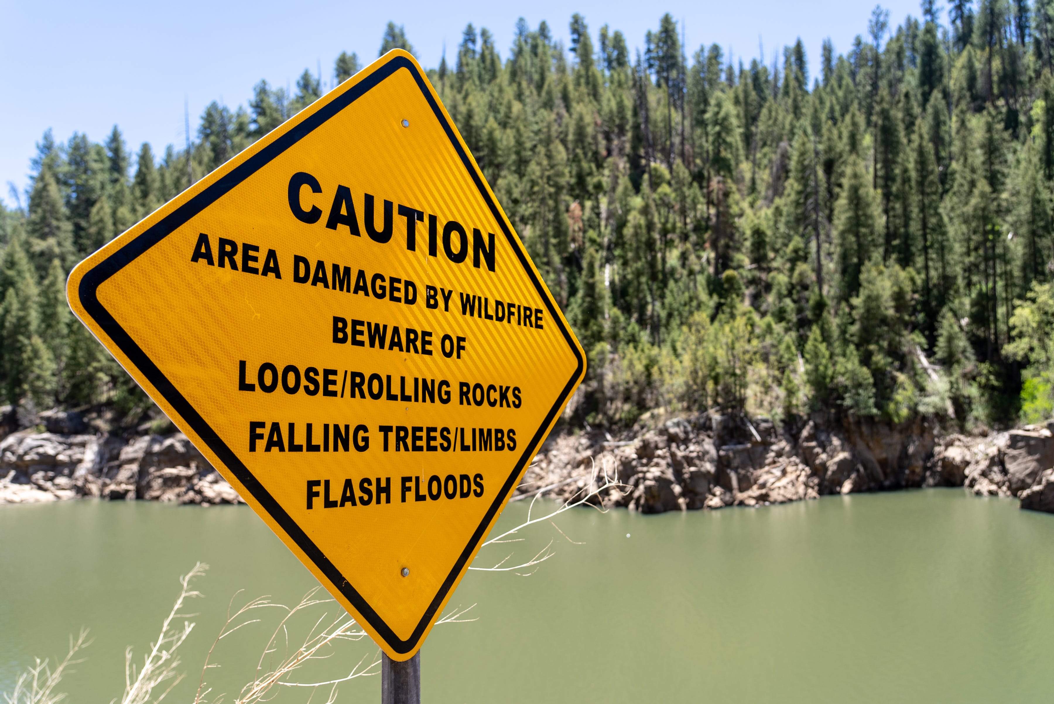
It’s a peaceful, pine-scented scene that cloaks the constant threat embodied by the watchtower and its staff. Out of view to the east, a 700-square-mile expanse of forest still struggles to recover from the 2002 Rodeo-Chediski Fire. That massive blaze burned across 468,638 acres, destroyed hundreds of structures and dumped ash, eroded dirt and contaminants into streams that flow to the Salt River and, ultimately, metro Phoenix.
A repeat here would choke off much of the water that the small city of Payson relies on, along with some that makes it to Phoenix in the Verde River.
Rodeo-Chediski’s severe burn, whipping from one tightly packed tree to the next and killing every one of them in huge patches, sounded the alarm that set foresters and hydrologists on a course to mechanically thin and sometimes burn off excess trees to protect a Salt River Project reservoir’s supply before the next megafire.
“That was, for lack of a better word, a watershed moment,” said Jeff Thumm, fuels specialist with the Forest Service’s Mogollon Rim Ranger District.
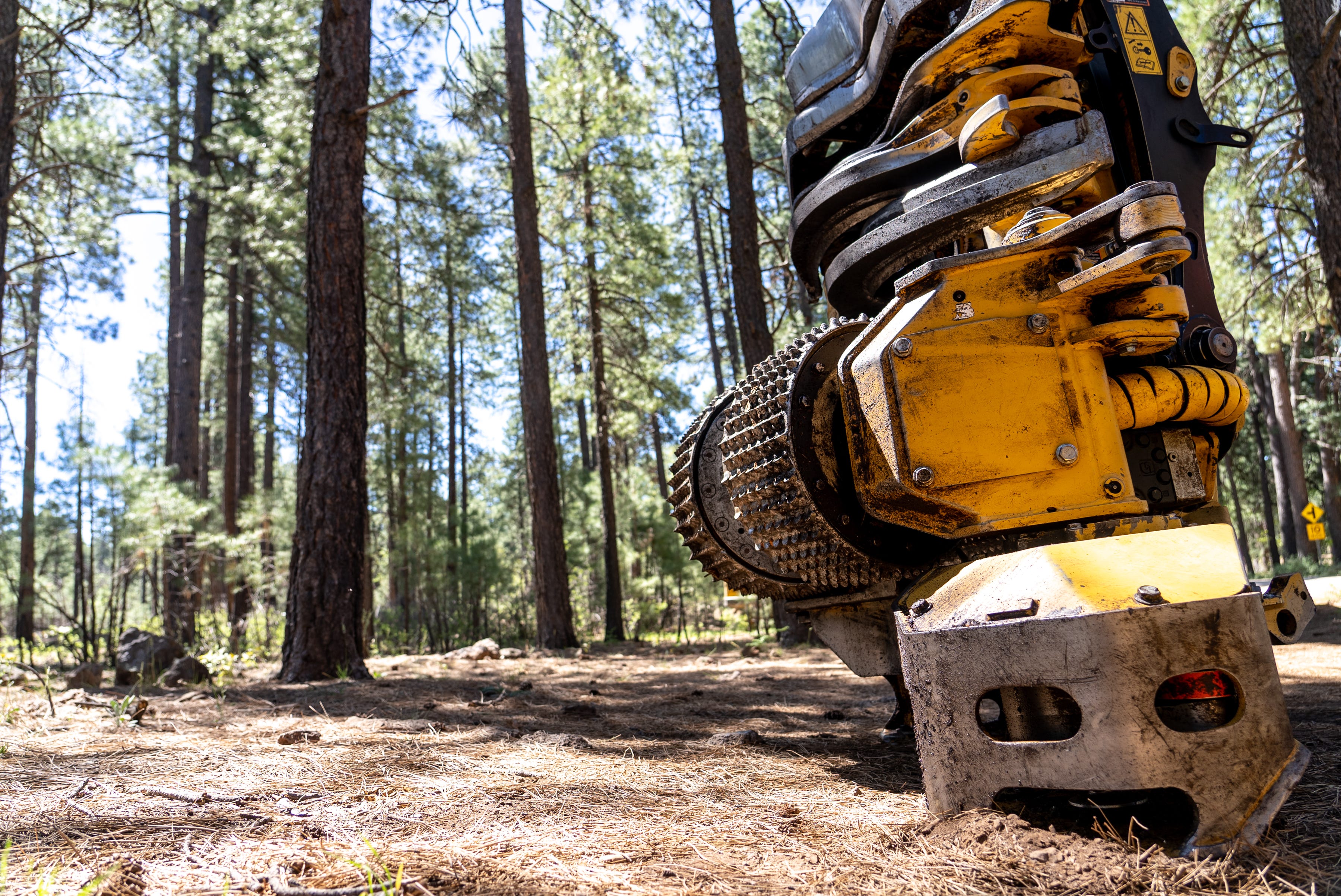
Their planning finally led to mechanical thinning that started last month. The hope is to thin more than 30,000 acres over 10 years, and to treat more with prescribed fires.
Treating forests before costly fires burn
Baker Butte rises above one of the Coconino National Forest’s productive watersheds, a 64,000-acre basin that pours snowmelt and rainfall into C.C. Cragin Reservoir, formerly known as the Blue Ridge Reservoir.
Cragin supplies more than half of Payson’s water, piped out of the Little Colorado River’s natural watershed and over the rim, where it descends to a municipal treatment plant. SRP takes the rest of the outflow to a tributary of the Verde River, where it flows toward Phoenix.
In 1965, the Phelps Dodge Corp. built the dam that can impound almost 5 billion gallons in the slender, forked canyon reservoir. That’s enough water to supply about 5,000 Arizona households when full.
When the company no longer needed it to support its mining, it turned ownership over to SRP. Payson gained a 27.2% share of the water through a watershed settlement that awarded it to Gila County, where the city sits under the rim and some 25 miles south of the reservoir.
SRP, a major Maricopa County water and power provider, responded to Rodeo-Chediski and the 2011 Wallow Fire farther east by gearing up to thin the tangle of pines around the reservoir. If the trees are left in their current state, standing too close together to grow fat and fire-resistant after years of fire suppression, the next megafire could destroy them all. The resulting stew of ash and mud could bury and block Cragin’s pipeline intake at the bottom of the lake.
The work ahead, a combination of thinning and prescribed burning when conditions allow, is expected to cost $62 million. Half will come from the Forest Service and half from SRP and partners, including Payson’s water customers. SRP is also tapping its Healthy Forest Initiative, using $3 fees that ratepayers volunteer to add to their monthly bills for restoration projects.
“It’s a drop in the bucket compared to the amount of damage that a wildfire could cause here,” said Elvy Barton, senior policy analyst with SRP.
An Electric Power Research Institute analysis in 2018 determined that catastrophic fire would cost all partners in the project up to $293 million, or almost five times what the restoration costs. The report determined that SRP alone would lose $99 million.
A big fire that burned in Colorado at the same time that Rodeo-Chediski was raging ultimately cost water providers in Denver and Aurora. They spent $25 million over two years to remove sediment from their supply after the Hayman Fire.
Cragin is the smallest of SRP’s seven reservoirs, Barton said, but is the only one in the high country and completely surrounded by ponderosa pine and its associated fire risks.
“This one is probably most at risk for catastrophic wildfire and infrastructure damage,” she said.
The others aren’t immune to fire’s damage. Rains pooling and running across the Rodeo-Chediski burn scar, for instance, temporarily clouded and altered the chemical composition of water entering SRP’s largest reservoir, Roosevelt Lake, to unhealthy levels, according to a 2015 study by Northern Arizona University and Forest Service researchers.

Guarding Payson's 'forever supply'
For Payson, population 17,000, protecting Cragin is about securing the future.
“We’ve dubbed Cragin Reservoir our forever supply,” said Tanner Henry, who directs the town’s water department. That’s because the water Payson takes from Cragin, along with what it pulls from the ground, should be enough for the town even if it grows to its expected capacity of 40,000. Growing beyond that point would be a challenge even with more water, as the town is surrounded by federal land, some of it on rugged terrain.

The share of water that Payson can pull through its pipe varies depending on the year’s rain and snow. Last year the reservoir only filled to 30% of its capacity, while this year it reached 70%. In a good year, there’s water left over to dump into the ground and replenish the aquifer that fills the town’s wells later, when the pipeline isn’t full.
Could Payson get by without water from Cragin?
“The population we have now?” Henry said. “Yes. The population in 20 years? No.”
Newcomers, often from California, scout and ultimately move to the town specifically because of its seemingly secure water supply, Henry said. Protecting that asset through forest restoration is a critical economic development tool.
Residents are on edge every fire season, waiting to see if the smoke they’re smelling indicates a threat to their homes or their water. Rodeo-Chediski is never far from mind.
“Just look what happened there,” Henry said. “We don’t want that to happen.”
Ratepayers are chipping in to thin the forest and give it a chance of maintaining some tree and ground cover to block erosion and sedimentation when the next fire moves through. But their risk is not just in losing the pipeline’s water intake. Fire also could take out the above-ground power line that runs parallel to the mostly buried pipeline and runs the pumps.

Thinning work will require subsidies
The Cragin watershed project is split into zones to be tackled one at a time for about the next decade. First up is the high country around Baker Butte Lookout, both because it’s vulnerable to fires that could speed up and over the Mogollon Rim and because its tower is an important tool in spotting and fighting fires throughout the area.
Protecting Baker Butte will require a local contribution of at least $700,000, with costs parceled out like this: $200,000 from a state forestry grant, $200,000 from SRP ratepayers who support the Healthy Forests Initiative, and $300,000 split roughly 73-27 between SRP’s regular forestry budget and Payson. The Forest Service, which has received $54 million in new federal infrastructure funds for restoring Arizona forests, will match all of that.
“We were lucky to have this planned already,” District Ranger Linda Wadleigh said. It’s essentially “shovel-ready,” or in this case, logger-ready.
But logging is not an industry that could handle the load simply by gaining access to the federal lands. The territory around Cragin, like much of northern Arizona’s pine forests, is far from processing plants, creating high haul costs. It’s also the small trees — those that are too crowded to grow to their potential, and those that don’t host Mexican spotted owls — that foresters want to remove for the benefit of the rest. Those trees tend to be less valuable, unsuitable for lumber milling.
The subsidy for thinning here can run $1,000 or more per acre, which is why the partners must pay to make it happen.
The trees are packed in by the hundreds or, in some areas, even the thousands per acre. The goal is to bring them down to 100-200 trees an acre.
“We want to keep the big, bushy, healthy trees,” said Shana Fitzpatrick, timber staff officer for the ranger district.
But they also want to protect some younger trees for variety, which are important for owls and can serve as insurance against a bark beetle outbreak taking out every tree at once.

Most trees of 24 inches diameter will stay, and foresters have painted them with orange paint to indicate that. Others of the same size got blue paint as a signal to cut them because they’re showing signs of disease. Some smaller trees with yellow bark, a sign that they’re at least 130 years old, also will stay.
The work around Cragin begins what SRP hopes will become 500,000 treated acres across its watersheds around the Verde and Salt rivers. The work is costly and the water provider is in a race against time and the next megafire.
“It’s definitely going to be an aspirational goal,” Barton said, “but at this point we are really ramping up.”
Brandon Loomis covers environmental and climate issues for The Arizona Republic and azcentral.com. Reach him at brandon.loomis@arizonarepublic.com or follow on Twitter @brandonloomis.
Environmental coverage on azcentral.com and in The Arizona Republic is supported by a grant from the Nina Mason Pulliam Charitable Trust. Follow The Republic environmental reporting team at environment.azcentral.com and @azcenvironment on Facebook, Twitter and Instagram.